


Brügglensteig
 |
CH (BE), 7.4199°E, 46.8367°N | |||
 |
883 m |  |
CH-BE-0883 | |
 |
Gerstern, 805m, 1km | |||
 |
Wydmaad, 812m, 1km | |||
 |


| |||
 |
(not yet translated into English:) faisable par la route des crêtes entre Voder- et Hinterfultigen | |||

Forclaz pass above Ollon, with Leysin in the background | ||||

View over La Forclaz from the road between Panex and Huémoz | ||||

Brügglensteig (to the left) as seen from Vorderfultigen | ||||

Valley of Bütschelbach as seen from Brügglensteig | ||||

From Brügglensteig over the Schwandbach valley, with the Schwendelberg and Guggershorn mountains a little to the right on the horizon | ||||
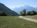
The Dents du Midi mountains as seen from La Forclaz | ||||

View towards Leysin from La Forclaz | ||||