


Col de Prarial
 |
FR (05), 6.7258°E, 44.9209°N | |||
 |
2013 m |  |
FR-05-2013 | |
 |
Montgenèvre | |||
 |
Montgenèvre | |||
 |
 |
 | ||
 |


| |||
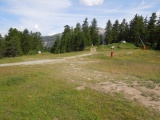
Prarial Pass, auf der Wasserscheide zwischen Doire und Durance | ||||
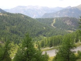
Col du Prarial vom Osten her | ||||
|
FR (05), 6.7258°E, 44.9209°N | |||
|
2013 m | |
FR-05-2013 | |
|
Montgenèvre | |||
|
Montgenèvre | |||
|
|
| ||
|
| |||
|
Prarial Pass, auf der Wasserscheide zwischen Doire und Durance | ||||
|
Col du Prarial vom Osten her | ||||