


Passo del Camoghè
 |
CH (TI), 8.6708°E, 46.5405°N | |||
 |
2178 m |  |
CH-TI-2178 | |
 |
Piora, 1851m, 2km | |||
 |
Madrano, 1156m, 6km | |||
 |
 |
 | ||
 |


| |||
 |
(noch nicht auf Deutsch übersetzt:) passage très escarpé, assez dangereux du côté de Piora | |||

Von der Bocchetta di Föisc zum Camoghè | ||||

Lago Ritom und Sicht auf die Leventina, mit dem Gipfel vom Pécianett in der Mitte | ||||
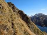
Südlicher Anstieg zum Passo del Camoghè | ||||
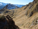
Sicht vom Passo del Camoghè zur Bocchetta di Föisc | ||||

Sicht gegen Osten vom Passo del Camoghè mit Lago Ritom und Val Piora, in der Mitte Pizzo dell'Uomo | ||||
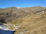
Alpe di Lago, Giübin und Pizzo Barbarea | ||||
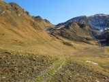
Alpe di Lago und Passo del Camoghè | ||||